2026 ALTA/NSPS Standards Training: What Drafters Must Know
- PrimaVersity

- Apr 23
- 8 min read
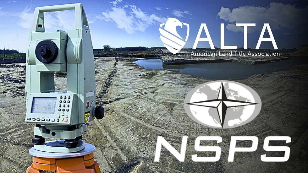
Most standard updates are a title block swap. Change the year, file the PDF, carry on. That is what a routine revision looks like, and for a long time, ALTA updates mostly fit that description.
February 23 was different, and if you have not taken a proper look at your workflow since then, you probably should. The 2026 ALTA/NSPS standards training conversation is not about ticking a compliance box. It is about understanding a shift that actually changes how drafters work.
Surveyors are now responsible for pulling adjoining deeds that title companies used to handle.
Conditions that used to sit in a corner callout now have to live on the Plat itself, tabled and dimensioned, visible to everyone who touches the deal. Field notes that nobody actually read have to become documented linework on the final drawing. That is a bigger shift than most revision cycles bring, and drafters who treat it like routine maintenance are going to find out the hard way.
These standards supersede everything before them. Any survey ordered after February 23 has to comply fully, and for drafters that means rethinking the whole workflow: how notes are written, how tables are positioned, and how research findings get reflected on the final drawing. It is a reset, and the sooner you treat it as one, the better.
The Changes That Actually Matter Day-to-Day
The land survey updates 2026 introduced can be sorted into roughly three tiers: changes to the research process, changes to depiction standards, and entirely new obligations. Not all of them land on the drafting table with equal weight, but you need to know which ones do.
Records Research Is Now Directly Visible
Records research is tier one. Surveyors are now responsible for securing adjoining property deeds themselves, no longer delegating that to title insurers.
For drafters, this ripples directly into the notes section of your Plat. What was obtained, from where, and when needs to be documented explicitly.
"County Records, Vols. 1204–1207, accessed March 2026" is the kind of specificity that now belongs on the drawing. If there are gaps, you explain them. Vague attribution doesn't hold up.
Field Method Flexibility Comes With Conditions
The flexibility on field methods is real, but it comes with strings. Drone and LiDAR data can now be incorporated, replacing the old "on the ground" mandate with "practices generally recognized as acceptable," but only with written client agreement specifying the data source and collection date.
If aerial imagery is overlaid on your Plat, it gets noted clearly and traceably. The openness is useful. it is not a free pass to skip documentation.
RPP Now Affects Drafting Output
Then there's precision. The Relative Positional Precision (RPP) standard, now anchored at a 95% confidence level via least squares adjustment with a 2 cm + 50 ppm cap, has real teeth.
Any deviation gets flagged explicitly on the Plat. RPP definitions used to live mostly in the field surveyor's domain, now they ripple directly into what a drafter writes in the certification and notes.
That is a shift worth building into your 2026 ALTA/NSPS standards training specifically, not just understanding the number, but knowing how it shows up in your output.

Table A Item 20: The New Centerpiece of Your Plat
If there was one change survey drafters should prioritize, it is Table A Item 20. This is the new required summary table, client-requested, but once requested, it has to appear on the Plat in a specific, functional way.
The old Item 20, which used to hold custom additions, has moved to Item 21. If your checklist has not been updated yet, that is the first thing to fix before you touch another project.
What the Table Actually Captures
The table records significant observed conditions on the ground. Not interpretations, not legal conclusions. Just what is physically there and where it sits relative to the boundary. That includes:
Encroachments over boundary lines
Something physical, like a fence, wall, or structure, is sitting on land it does not legally belong to. This matters because it creates a dispute the next owner inherits. It shows up when a structure was built without checking the actual boundary line.
Intrusions into easements, rights-of-way, or setbacks
A structure or improvement has been placed inside a zone that is either reserved for another party or restricted by code. It matters because it can block utility access or violate zoning, which stalls permits and closings. It happens most often when older improvements predate the recorded easement or the owner simply was not aware of it.
Third-party use without any apparent easement
Someone is using the property regularly, crossing it, parking on it, running a line through it, without any recorded right to do so. It matters because undocumented use can ripen into a legal claim over time. It surfaces during fieldwork when evidence of use is visible but no easement exists in the records.
Access that only works because of common ownership
The property can only be reached by crossing land that is currently owned by the same person or entity. It matters because the moment that adjacent land is sold separately, the access disappears. It is easy to miss in research because nothing looks wrong until ownership changes.
How It Should Be Drafted
The surveyor is not opining on legal ownership, the standards make that explicit, but the conditions are documented clearly and completely.
In drafting terms:
Use dashed linework for apparent encroachments
Add labels that tie directly to table entries
Include dimensions that make the issues scale legible
The table itself should probably live as an inset, with columns for location, description, dimension, and condition type. Color coding, such as red for boundary crossings and orange for easement intrusions, works well if it is consistently applied and properly legendered.
The point is simple. Someone picking up this Plat for the first time, without the field surveyor present, should still be able to read it accurately.

What Nobody Really Talks About: The Research Burden Shift
The adjoining deed requirement is practical enough on its face, but it creates a cascade effect worth thinking through carefully.
Surveyors are now gathering more records than before. That means more potential for discrepancies to surface, between a recorded easement and what exists on the ground, or between a neighbor's deed and the boundary the field crew located.
Every one of those discrepancies needs handling on the drawing.
What Must Be Shown
A recorded easement that isn't field-evident should appear with distinct symbology and a clear label
A parol statement from an owner about a boundary must be explicitly noted
Conflicts should be clearly represented, not implied
These aren't optional elaborations. They're part of what the 2026 standards expect. Title insurers need accurate risk data, and lenders need to understand what they're financing.
Practical Drafting Advantage
Building template legend entries for these situations now, before deadline pressure forces shortcuts, pays off fast.
Entries like:
"Recorded Easement – Not Observed in Field"
"Apparent Boundary Per Owner Statement – Not Verified"
These aren't just professional. They're protective. They show the research was done and the limits are disclosed.
Your Workflow Needs to Change, Not Just Your Template
Most firms will update the title block, swap the year, and call it done. It has worked before with lighter revisions, so the instinct makes sense. The problem is that the 2026 changes ask for more than that, and a template refresh alone will not be enough.
The scope of what a compliant Plat documents is genuinely wider, and the workflow has to match.
Why Training Matters
This is where structured 2026 ALTA/NSPS standards training makes the difference between surface-level compliance and actual fluency.
NSPS webinars have covered some of this, and state societies like IPLSA have run 2026-specific sessions. The investment is typically $200–500, and the return shows up quickly in fewer revision cycles and fewer questions from title reviewers.
A good boundary drafting course focused specifically on the 2026 changes will walk you through the practical decisions, where the Item 20 table sits on the drawing, how to distinguish boundary types visually, and how to handle aerial overlay. That is the kind of applied learning that webinars alone usually do not cover.
Software Considerations
For software users, this is a good moment to look at AutoCAD Civil 3D customization.
Scripting a table generator for Item 20 fields saves time
Standardizing annotation improves consistency
Integrating RPP-related note structures reduces errors
Getting comfortable with least squares adjustment tools for RPP certification is also worth a few hours of practice now, rather than a scramble later.
The Business Reality Nobody Warns You About
More research, more tables, more documentation, this adds time.
Realistically, fees on complex ALTA surveys are running 10–20% higher under 2026 standards. That is a conversation worth having with clients upfront, not after the invoice lands.
The Upside
The flip side is real. Surveys delivered under these standards are genuinely more useful.
The Item 20 table highlights issues early
Easement clarity reduces permitting surprises
Lenders and developers get better visibility
Firms that deliver this level of clarity stand out. For drafters, being the person who can handle complex, high-clarity work builds long-term value.

The Skills You Build Now Will Keep Paying Off
Standards will update again. They always do. But the skills underneath do not expire with the next revision. Reading title commitments carefully, turning complicated field conditions into clear drawings, documenting research so nothing gets missed. A boundary drafting course that is built around current standards gives you that foundation in a structured way rather than picking it up through trial and error on live projects. These matter in 2026 and they will matter in the next cycle too.
Good 2026 ALTA/NSPS standards training is an investment in how you work, not just what you submit. If your foundation in civil design and engineering needs some work before you can fully engage with these updates, PrimaVersity's Foundational Civil Design and Fundamentals in Civil Engineering courses are a practical place to start. Built for working professionals, not classrooms. The requirements will keep changing.
FAQs
1. Why do ALTA surveys create problems right before closing?
They do not create the problems. The problems were already there. The survey just finds them at a stage when everyone has already mentally moved on. Pricing is set, financing is arranged, dates are booked. So when something shows up on the drawing, it feels like a disruption even when it is exactly what the survey was hired to do. The issue is not the finding. It is that nobody looked earlier.
2. Why does an ALTA survey cost more than clients expect?
Because most clients are comparing it to what surveys used to cost. The 2026 standards changed how much work goes into each one. More records to pull, more conditions to document, more to show on the final drawing. What the client sees is a sheet of paper. What went into that sheet is not obvious unless someone explains it. That gap is where the sticker shock usually lives.
3. Why does a simple-looking site still raise concerns in a survey?
Because what you can see and what is recorded are often two different stories. A site can look completely fine on a walkthrough. No obvious issues, no visible disputes, nothing that raises a flag. But then the records come back and an easement shows up that nobody mentioned, or the boundary description does not quite match what the neighbor filed years ago. The survey crosses both.
4. Why does clarity matter more than just adding more detail?
A lender does not read surveys for fun. Neither does an attorney or a title underwriter. They open it, find what they need, and move on. If the drawing is confusing, they stop. And when they stop, the deal slows down. More detail on a drawing does not automatically make it better. Clarity does.


Comments